Essential Maps for Navigating Seoul: Official Tourist Guides and Hiking Trails
While navigating a massive metropolis like Seoul (서울) might seem intimidating at first, the city offers some of the most comprehensive, accessible, and foreigner-friendly maps in the world. Whether you prefer folding out a colorful paper map over a coffee or tracking a digital GPX file on your smartphone, having the right guides will elevate your trip from a standard vacation to a seamless adventure.
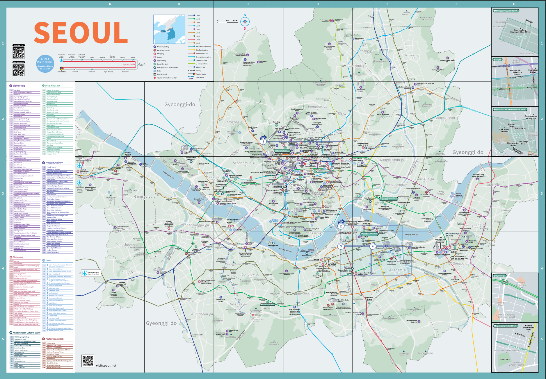
Seoul offers two primary types of maps that every traveler should know about: the general Tourist Map (for city landmarks, shopping, and palaces) and the specialized Hiking and Trail Maps (for exploring the incredible mountains surrounding the city). Accessing these maps is incredibly easy and, best of all, entirely free!
In this guide, we will break down where to pick up these official maps, what kind of content you will find inside them, and the best starting points for both urban exploration and scenic mountain hikes.
🌟 Why You Should Visit
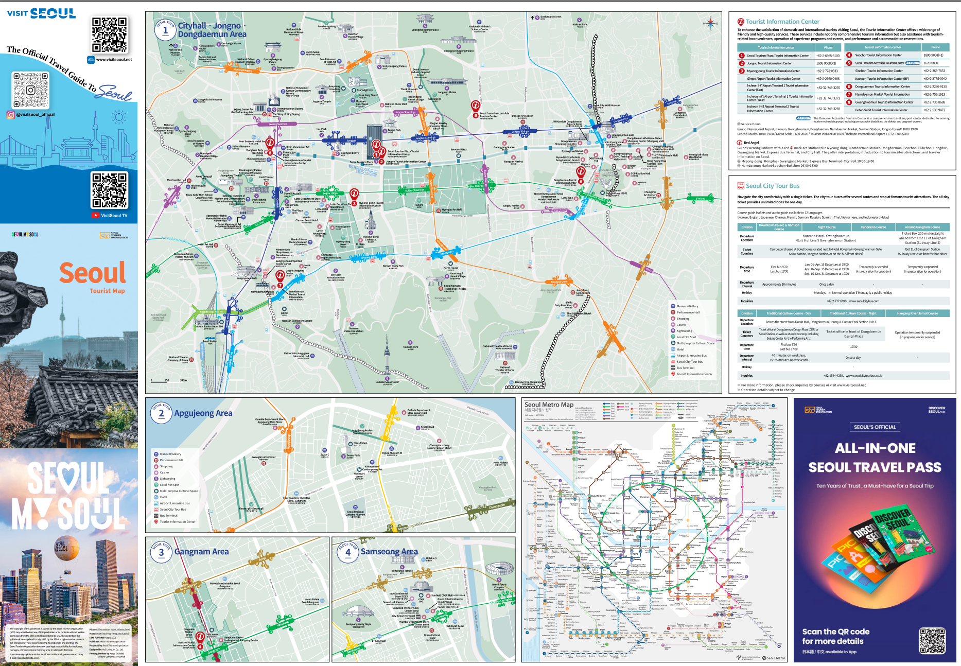
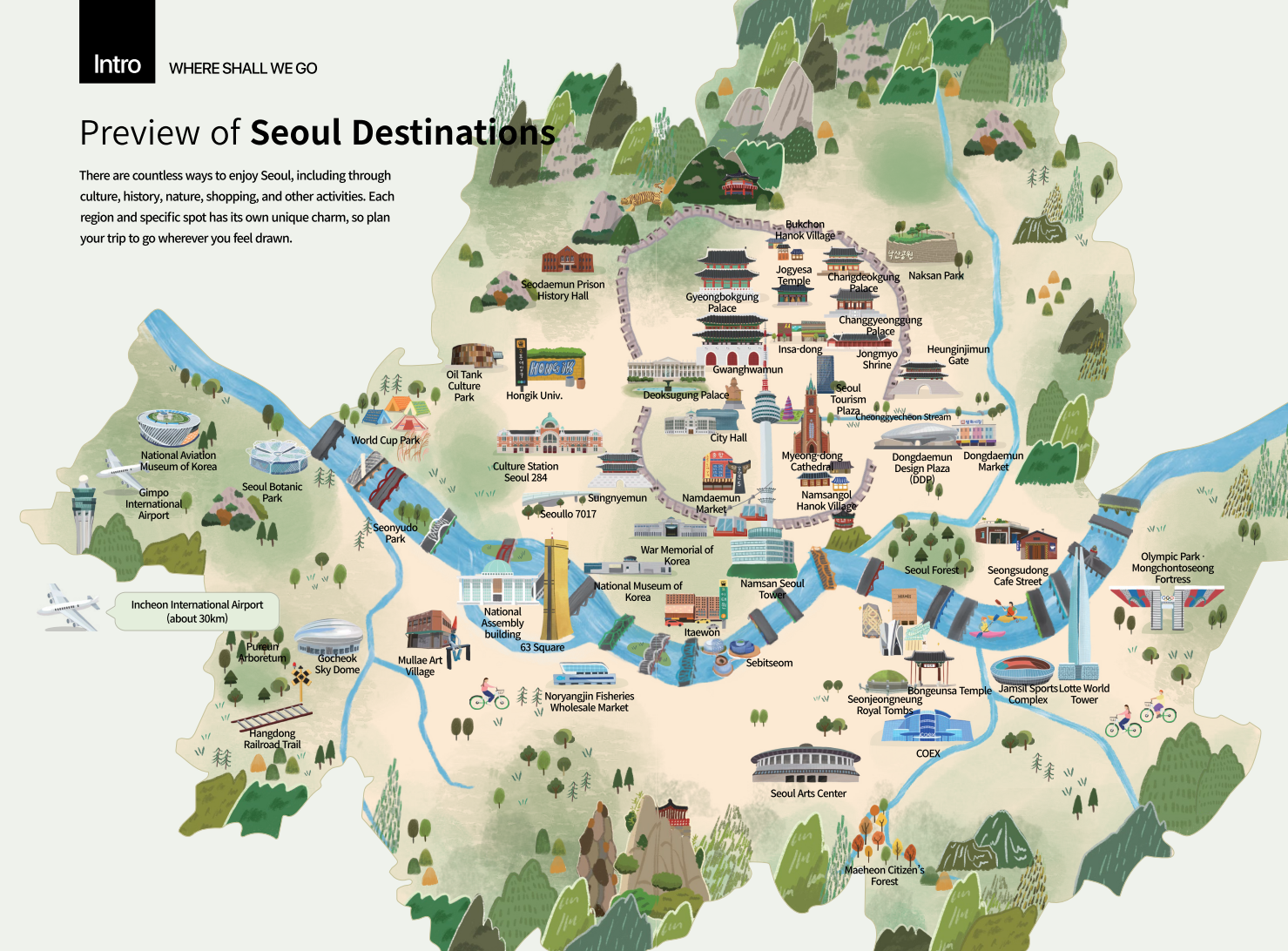
- Comprehensive City Navigation: Whether you are exploring historical palaces or modern shopping districts, having the official Seoul Tourist Map ensures you won't miss any major landmarks. It contains detailed subway routes, cultural sites, shopping zones, and emergency contact info.
- Unlocking Seoul's Natural Beauty: The Seoul Trail (Dulle-gil) and hiking maps guide you through the lush mountains and riverside paths surrounding the city. These maps provide elevation details, rest stops, and stamp tour locations for an unforgettable outdoor adventure.
🍽️ / 📸 What to Experience & Top Picks
Here are a few must-visit spots to gather your maps and start your journey:
- Seoul Tourism Plaza Tourist Information Center (서울관광플라자 관광정보센터): This is the ultimate hub for grabbing physical copies of the Official Seoul Tourist Map (서울관광지도) for free. The map includes detailed layouts of tourist hotspots like Myeongdong and Hongdae, as well as transit info. If you prefer going digital, you can also download the PDF versions via the official Visit Seoul website.
- Seoul Trail Center Yangjae (서울둘레길 안내센터 양재): If you are interested in the Seoul Trail Map (서울둘레길 지도), stop by this center. The newly updated Seoul Trail 2.0 has 21 beautiful courses encircling the city. You can pick up a physical hiking map and a stamp book here. The map contents highlight course difficulty, scenic viewpoints, and transit connections. For digital hikers, you can find GPS/GPX files for all courses on the Smart Seoul Map (스마트서울맵) website.
- Bukhansan National Park (북한산국립공원): For more intense hiking, Bukhansan offers some of the best mountain trails in Korea. You can grab specific Bukhansan Hiking Maps (북한산 등산지도) at the park's main entrances or visitor centers. These maps outline various peaks, including the famous Baegundae Peak, as well as historical temples and fortresses along the way. Admission to the park is completely free (0 KRW).
https://map.seoul.go.kr/global/tourmap
스마트서울맵, 매력서울지도
map.seoul.go.kr
🚇 How to Get There (Public Transportation)
- Subway: Line 1, Jonggak Station (종각역), Exit 4 (approx. 5 min walk to Seoul Tourism Plaza).
- Step-by-Step Directions: Walk straight from Exit 4 alongside the beautiful Cheonggyecheon Stream (청계천). The Tourism Plaza will be easily visible on your right, providing immediate access to all the urban maps you need.
- Transit Tip: Download the 'Smart Seoul Map' (스마트서울맵) on your phone's browser for digital hiking trail routes, and keep your T-Money (티머니) card loaded for seamless bus and subway rides to the mountain trailheads!
💡 Practical Traveler Tips
- Best Time to Visit: If you plan on hiking the Seoul Trail or Bukhansan, aim for the spring (April-May) or autumn (September-October) for the most pleasant weather and stunning seasonal foliage.
- Payment & Reservations: All official tourist maps, Seoul Trail maps, and stamp books are completely free of charge. No advance reservations are required to visit the information centers.
- Local Etiquette: When hiking in Korea, it is common to greet fellow hikers on the trail with a friendly "Annyeonghaseyo" (안녕하세요). Always pack out your trash and stay strictly on the designated mapped paths.